Ever have an alternative view of London, such as where to get the best cocktails or learn the history of music in the city? Why not create your own illustrated map of London? This idea started from a series of books for families to explore London and learn about different stories while they explore various areas in London. The books can be found here: London Adventure Walks for Families: http://www.adventurewalksforfamilies.co.uk/.
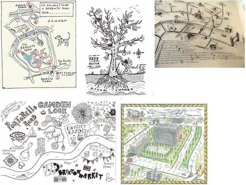
1) 101 Dalmatians Walk: This map features the areas that map-readers can explore in the classic Disney story.
2) Brixton as a Tree: This map depicts the area of Brixton with the roads as branches and the illustrator's favourite cafes and pubs as fruit hanging from the branches.
3) London Firsts: This map shows some of London's first achievements, such as the first broadcast and police force.
4) Markets: The illustrator created a map with decorative text and imagery to provide details about the speciality of the market.
5) Grosvenor and Berkley Squares: Depicts the famous squares in Mayfair.

6) Detail of illustrated music map of London by Pixie.
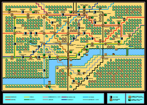
7) Super Mario London TUBE map - Naturalbeats

8) London Lego map in the Lego store in Leicester Square. Note that there were also a series of historical tube maps in Lego in a few of the London underground stations a few years ago.
For more examples of London maps, see: http://mappinglondon.co.uk/


Leave a comment